Tuesday, 30 May 2017
Gig
Carleen Anderson: Cage Street Memorial
There are a few artists who you just have to see perform live when you get the chance. Carleen Anderson is absolutely top of the list for me, having one of the most versatile voices I've ever heard.

In recent years, Carleen's been exploring different ways of exploring the story of her roots in America's gospel-rich deep south, and her migration to the UK. And so her first words tonight welcomed "the congregation," and the show journeyed seamlessly between gospel, jazz, soul and blues backed by her virtuoso band.
It was an astonishing and unmissable evening, even though the theatre was barely half-full. Music fans of Oxford take note: you missed out on a legend.
Monday, 22 May 2017
Film
Miss Sloane
 Miss Sloane is a fantastic thriller set deep amidst the lobbying world of Washington DC. Jessica Chastain barely leaves the screen and deserves all the accolades she has received for the ice-queen act that doesn't let up one minute.
Highly recommended.
Sunday, 7 May 2017
Inverness, Loch Ness and the North East Highlands
The Forest in the City
 Distance: 2.06 miles
Ascent: unknown
Duration: 35 minutes
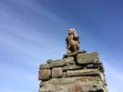
Walk 2: Craig Phadrig
While Emma has a well deserved lie-in, I slipped out this morning for a final walk before we head to the station. Though I remarked yesterday that Inverness isn't surrounded by high hills, it does have a few elevated spots. Craig Phadrig is one of them: a steep-sided dense wood rising to 172 metres, capped with an old hill fort.
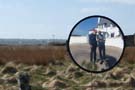
There was nobody around, and on the route I found myself face-to-face with a deer.
I love our long walks, but a short trip like this reminds me well that you don't have to go far to find serenity.
Time for breakfast. Then home.
Saturday, 6 May 2017
Inverness, Loch Ness and the North East Highlands
'Ness
 Distance: 4.94 miles
Ascent: 81 metres
Duration: 1 hour 57 minutes
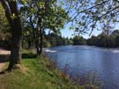
Walk 4: Ness Islands and Tomnahuirich
Inverness surprises me every time I visit. I always expect this town at the northern end of the Great Glen to be surrounded by high mountains, but in practice you have to go a good few miles before reaching any land more than five hundred metres above sea level.
This walk eschews the hills altogether and captures the genteel side to Inverness by following the chain of small islands that add interest to the River Ness. It then touches the Caledonian Canal, and climbs the necropolis at Tomnahuirich.
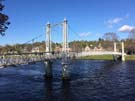 It's very Victorian: cast iron railings and suspension footbridges along the river, and grandiose memorials in the cemetery.
It's also a great way to relax after a hectic fortnight of hiking. We'll spend all of tomorrow on the train slowly winding our way back south. But for now, the Capital of the Highlands is captivating.
Friday, 5 May 2017
Coastwalk
Brough → Castletown
 Distance: 12.05 miles
Ascent: 352 metres
Duration: 4 hours 45 minutes
The North
« John o' Groats | Weymouth »
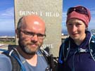
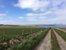
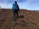
While tourists consider John o' Groats as the top corner of Scotland, plenty of bores will point out that Dunnet Head is the place which really wears that crown. This is the most northerly point on the island; the general direction of all our walking is south now.
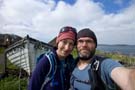
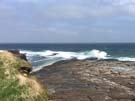
 As a final coastwalk for this year we've taken a full circuit of the headland.
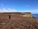
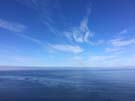
But if you look at walking guides to the area you'd be led to believe it's not possible. There's a road to the lighthouse at the tip and a frequently described path down the western side, but we couldn't find any suggestion of a path along the east. Fellow hikers: it exists, or rather, the route is eminently walkable, and with the sun flooding the heather slopes it's absolutely gorgeous.
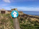 Where the B855 turns inland to climb Dunnet Head we noticed a small disc waymark that gave us hope. Inscribed the North Highland Way, it seems to be the genesis of a walking route along the north coast. We'd be inclined to try and follow the route, but saw no further waymarks all day. (Perhaps like the Cumbria Coastal Path the route has been abandoned.)
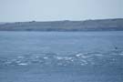
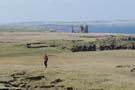
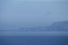 From the northernmost point of our island we looked across to the island of Hoy. Standing proud above the bulk of the landmass was the top of the Old Man of Hoy, a famous sea stack which will certainly be on our itinerary when we finally visit the Orkney Islands. (We really are spoiled for choice when it comes to places to visit on the Atlantic Archipelago.)
 After traversing the beach at the back of Dunnet Bay we finished our walk at the Castletown harbour. Apparently in the 18th and 19th centuries flagstones were shipped out from here to pave the streets not just of Edinburgh and London, but also Sydney and New York. Reconciling that with the deserted quayside and sleepy village took a significant stretch of the imagination.
 So that's our last coastal walk for the year. Our goal for 2018 is to reach Cape Wrath and complete the north coast of Scotland. Walking the east and north coasts will have taken five years; we expect the west coast to take twice as long. Would you consider joining us?
Notes for future walkers:
- The east side of Dunnet Head is walkable! Head north from the corner of the B855 at ND 219 741 and stay near the clifftops.
- The trickiest part of the west side of the Head was the two steep descents from Chapel Hill, mainly due to the misleadingly large number of paths that want to take you inland.
- From Dwarwick Pier we started walking outside the fields but soon had to hop the fence where the path was eroded; best stay inside the fields all the way.
- We descended to the beach of Dunnet Bay at ND 214 710 and stayed there all the way to Castletown. Neither the Burn of Midsand nor the Burn of Garth were difficult to cross (though the latter was deeper).
Thursday, 4 May 2017
Coastwalk
John o' Groats → Brough
 Distance: 12.71 miles
Ascent: 196 metres
Duration: 3 hours 52 minutes
West from the Dutchman's house
« Keiss | Castletown »
With LE-JoG done, it's time for us to pick up on JoG-LE again. We're heading west.
The walk started out well with a good footpath leaving John o' Groats, but that quickly petered out. We soon tired of trying to find a coastal route across fields so dropped back to minor roads.
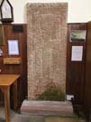 A tombstone in the church at Canisbay marks the grave of a Dutchman, Jan de Groot, who was granted a license to run a ferry to Orkney. It's curious seeing evidence that Jan was anything other than a fable, dreamt up as a quaint story to tell tourist day-trippers about how a place got its name.
 In an attempt to encourage more tourists to the far north of Scotland, a touring route — the North Coast 500 — has been created. Its popularity has rocketed of late and we were expecting the roads we walked on today to be busy with NC500 cars and bikes, but traffic was reasonably light.
 We eventually hit the beach again just before the Castle of May, a collection of tall, square stone towers looking out over the Firth, chiefly famous for being a favourite haunt of the Queen Mother. On any other day, we would have stopped to explore the stone-walled gardens and enjoy a pot of tea in the castle grounds. Instead we dashed past the gates and paced on along the roadside to Brough to catch the bus back to Jan de Groot's old house.
Notes for future walkers:
- From the John o' Groats signpost there's an excellent path leading west, but it stops just after a track heading inland at ND 377 734. We took the track to the A836 to Huna.
- In Huna (ND 358 733) we tried to follow the coast again, but it was too rocky so headed inland again from the Haven of Seater (ND 354 732).
- For a little relief from the A836, turn off on a winding local road just after the road to Gills Pier (ND 326 726, ND 325 727, ND 326 727, ND 324 727, ND 321 728).
- We turned off the A-road again at ND 311 738, continuing onto a track to the shore at ND 293 745 past the Castle of Mey to Harrow (ND 290 741, ND 282 741, ND 281 973) before following local roads (ND 273 745, ND 265 744, ND 244 727, ND 237 737) all the way to Brough.
Wednesday, 3 May 2017
Coastwalk
Keiss → John o' Groats
 Distance: 14.05 miles
Ascent: 352 metres
Duration: 5 hours 32 minutes
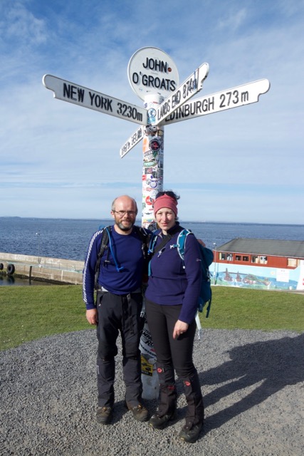
Where the land runs out
« Wick | Brough »
 Ask anybody about the extremities of our island and they'll mention John o' Groats. The journey from Land's End in the south-west is so famous that even purists, who know the place has no geographic significance, have to admit there is at least a psychological consequence of reaching this destination.
 However, for us the most exciting moment came much earlier. As we climbed the Hill of Crogodale we saw for the first time the island of South Ronaldsay, one of the Orkneys, separated from the mainland by the Pentland Firth, running white with the wild water of the Boars of Duncansby. After so many years of heading north, we were reaching a turning point, the moment when our island runs out.
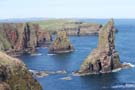 As ever the scenery was the star: the springy heather of the clifftops; the Stacks of Duncansby below; the never-ending swirling of the sea-birds darting between nests.
John o' Groats itself may be little more than a small harbour, a café, a signpost and an oversized car-park, but the signpost is the reason everyone gathers here. We arrived shortly after a group of cyclists who were making a big deal of their thousand-mile ride from Land's End. Our LE-JoG walk has taken us 2,400 miles and we've still got JoG-LE to complete yet.
Notes for future walkers:
- We found it relatively straightforward to walk outside the fields on the coast all the way from Keiss to Freswick (though it was a little tight in places).
- We crossed the Burn of Freswick on the bridge behind Freswick Castle (ND 377 671), then took the track up from the beach (ND 378 677) to the minor road (ND 377 679) which we followed to its end (ND 392 686).
- From the road end we continued along a track to the quarry (ND 395 687), then headed north across the heather and bog staying relatively close to the clifftops all the way. The going was a bit damp, but not difficult.
Tuesday, 2 May 2017
Coastwalk
Wick → Keiss
 Distance: 11.80 miles
Ascent: 173 metres
Duration: 4 hours 10 minutes
Castles and beaches
« Lybster | John o' Groats »
 At last, we've left the main roads! It's a little too far for us to reach the end of the east coast today so we split the remaining distance at the hamlet of Keiss which is well-served by the John o' Groats to Wick bus.
 The walk was of two halves: first a clifftop amble past the lighthouse and castles on the Noss headland, followed by a four mile walk along the sands of Sinclair's Bay.
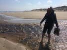 About one third of the way along the bay, the Burn of Lyth empties into the North Sea. The books we'd read suggested that this was a potentially deep and treacherous river, but we found we could cross it with little difficulty.
Just after the Burn an arrow-straight railway runs inland, perpendicular to the beach, for five miles. Pipeline packages are constructed on the railway and then dragged out to sea. One imagines this may present a more difficult obstacle to cross from time to time, but there was activity today.
Notes for future walkers:
- There's a good signposted path around North Head in Wick from ND 336 950.
- We stayed on the minor road through Papigoe and Staxigoe to Field of Noss Farm.
- From the farm, a good path leads via Noss Head and Castle Sinclair Girnigoe to Ackergill Tower (ND 352 547) where we joined the shore.
- We had no problem wading across the River of Wester on the beach (ND 340 576).
Monday, 1 May 2017
Coastwalk
Lybster → Wick
 Distance: 17.18 miles
Ascent: 376 metres
Duration: 5 hours 39 minutes
He might return to Whaligoe
« Dunbeath | Keiss »
We had hoped to spend most of today on tracks and paths, but after being frustrated by overgrowth early on near Occumster we once again reverted to the road. Surely tomorrow we'll have more success. With a fair distance to cover, we got our heads down and paced forwards, no doubt missing plenty of spectacular coastal scenery. (Evocatively named places such as Craig a Backy and Muckle Red Craig will have to remain in our imagination.)
In all honesty missing out wasn't such a hardship, since we knew precisely where to find a remarkable feature that would more than make up for it.
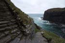
 The Whaligoe Steps aren't signposted from the road. They're also not exactly prominent on the Ordnance Survey maps either, but I've known about them and been looking forward to visiting them for years. I first came across them in Billy Connolly's World Tour of Scotland almost twenty-five years ago.
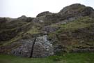
Built to service a tiny fishing harbour, 350+ steps zig-zag their way down the impossibly steep seventy-metre cliffs. My favourite story though, is of the lady who resurrected them years after harbour had been abandoned. "Since Christ was a fisherman," she reasoned, "when he comes again he might come by boat". With the steps repaired, were he to land at Whaligoe Jesus would at least be able to reach civilisation.
 Whether this comment is tongue-in-cheek or an earnest calling, the story — like the Bible verses painted on harbour walls — affirms the deep commitment to faith that still pervades this corner of our island.
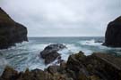
Today the waves were breaking hard on the Whaligoe rocks and it was difficult to imagine anybody ever landing a boat here, let alone doing so on a regular basis.
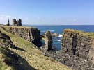
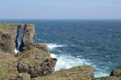 We followed the main road until just outside Wick where we finally found a reliable path to the clifftops at Old Wick Castle. The seascape here is stunning: tall cliffs pounded by the relentless sea, stacks and crags somehow resisting erosion, and slender natural arches that looked gossamer-thin.
 On the edge of the small town the path passes the Trinkie tidal swimming pool cut into the rocks, and then drops to the harbour side. We rolled our eyes at the tourist information sign that told of days when there were so many boats "you could walk from one side of the harbour to the other without getting your feet wet" — almost every coastal town seems to claim this.
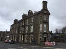 What nowhere else can claim though, is the shortest street in the world. Scarcely long enough for its signpost, Ebenezer Place is formed by the narrow doorway at the sharp end of a wedge-shaped hotel.
Wick had an air of sadness about it, but nonetheless survives. With eyes closed we could see the bustling port that it once was, when the hotels were all full and the planned town around the distillery had shops on every corner.
I can't help but think that in the era of the Digital Economy places like this would be ideal for telecommuters, but for some reason that's a revolution still to come. Perhaps I need some of that quiet faith that Wick will gain a new life.
Notes for future walkers:
- We spent most of the day on the A99, but started on local roads (ND 248 354, ND 252 357). We had tried to continue further on tracks through Mavesy but got stuck at ND 261 358 so retreated to Hillhead house and rejoined the main road at ND 257 363.
- Be sure to visit the Whaligoe Steps; access is from the end of the lane at ND 320 403 (not signposted, although the road opposite the lane is signed to the Cairn of Get).
- We left the A99 for the last time at ND 357 484, joining the coast near ND 365 480. Go to the coastal side of the fence as soon as you can.