Friday, 31 March 2017
Gig
Nadine Khouri

After seeing Nadine Khouri in a support slot in Glasgow we were keen to her headline a show. Tonight at St Pancras Old Church she didn't disappoint. Opening with the first two tracks from her album set up the gig perfectly.
Performing as a four-piece gave more depth to the sound, but I think I'd preferred her solo set. Either way she's an artist we'll be keeping an eye on in the future.
Monday, 27 March 2017
Film
Life
 If Hollywood made a sinister Doctor Who episode called "Squids in Space", eliminated the title character and pushed it into a downbeat register they'd end up with something very similar to Daniel Espinosa's film "Life".
It's a big-production, brainless, box-ticking space melodrama but nevertheless a reasonable way to while away the last afternoon of a two-week holiday.
Wednesday, 22 March 2017
Offa's Dyke Path
Bodfari → Prestatyn
 Distance: 12.02 miles
Ascent: 679 metres
Duration: 4 hours 7 minutes
Completing the circuit
« Not walked | Colwyn Bay »
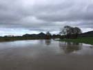
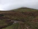
Frankly today's been a bit of a disappointment. It started last night when I saw the weather forecast which turned out to be depressingly accurate: after a week of reasonably dry walking, I was in for another soaking.
 But more than that, there were no real thrills to the walk. It felt as though all I was trying to do was get to the finishing line on Prestatyn prom, plodding on along country lanes and across increasingly muddy fields.
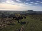
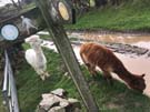 There were a few notable moments: watching the clouds lift from the snow-capped summits of Snowdonia to the west; meeting two llamas who were grazing freely on a farm track at Tyddyn-y-cyll, and chatting with the woman who was out reconnoitering the route for her six-day assault on Offa's Dyke Path in August.
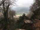
I suppose I shouldn't be too down though. Today was always going to be about the end, and when the rain stopped I slowed my pace to savour the last high walk on Prestatyn Hillside before dropping down into the town.
So that's it. The final Welsh National Trail complete, and my eighth overall.
Where to next? I currently have two further National Trails partly complete so I'd like to knock off the rest of the North Downs Way and Cleveland Way this year. That would just leave one southern National Trail (the Cotswold Way) and four in the north (the Pennine Way, Pennine Bridleway, Yorkshire Wolds Way and Hadrian's Wall Path). It's time to set myself a challenge: I'd like to complete all of these by the time the England Coast Path officially opens in 2020. I'd best get planning.
Notes for future walkers:
- After you've finished, pop in to the leisure centre right next to the end marker. At reception they hold a visitors' book for completers to sign. I was only the second in 2017.
Tuesday, 21 March 2017
Offa's Dyke Path
Llandegla → Bodfari
 Distance: 19.31 miles
Ascent: 1507 metres
Duration: 7 hours 2 minutes
The end in sight
« Not walked | Not walked »
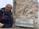
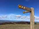
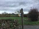
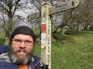
The theme of today's walk was set by the fingerpost sign right at the start. "Prestatyn 29" it said. This is only the third signpost I've seen with a distance to my final destination. Under thirty miles. The end is in sight.
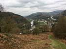
And then a short while later the end was literally in sight, since on attaining the Clwydian Range I saw the sea for the first time since leaving Chepstow.
It's been a gloriously sunny day, but the cold wind hasn't quite made it t-shirt weather.
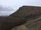
 The sun has brought people out in numbers. Over the succession of hillforts that cap the Clywdian Mountains I met more people than I have for the rest of the week combined. Most popular seemed to be the walk to the Jubilee Tower that dominates the summit of Moel Famau ("mother mountain").
From here I could see many familiar places: Prestatyn of course, but also the mouth of the River Dee at Talacre, the entire Wirral peninsula with Liverpool beyond, and way in the north the forest at Crosby. My focus though is the first of these: Prestatyn and the end of the walk.
Monday, 20 March 2017
Offa's Dyke Path
Pentre nr Chirk → Llandegla
 Distance: 16.02 miles
Ascent: 743 metres
Duration: 5 hours 28 minutes
The rainy day
« Not walked | Not walked »
 I knew it couldn't last. Ever since setting off nine days ago I've managed to stay broadly dry, but this morning I woke up to the sound of heavy rain hammering down on the roof of the B&B. I enjoyed an hour of sunshine in the middle of the day and another as I finished off the walk so it's not been entirely bad, and certainly not a patch on the downpours I endured on Glyndŵr's Way last summer. My new waterproofs have proved themselves very well.
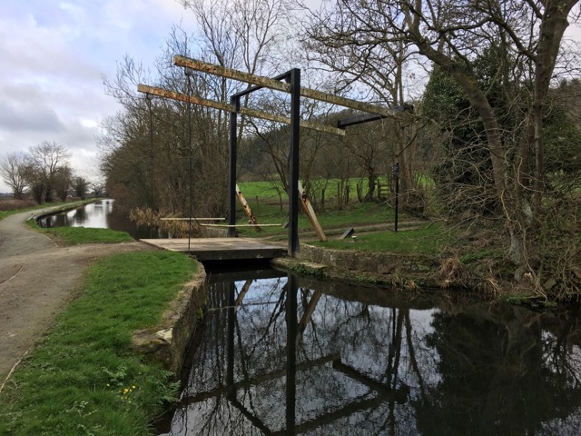
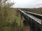 The highlight of the day was undoubtedly Pontcysyllte Aqueduct. Even without its quantitative achievements (longest and oldest in the UK, highest in the world) this would be a remarkable piece of engineering. It famously only has a protective fence on the towpath side of the canal, resulting in an exhilarating sense of exposure to the drop to the river 38m below.
 The weather forecast for tomorrow is much colder and dry but with very strong winds. It'll be a long walk over the mountains.

Notes for future walkers:
- Accommodation is scarce in Llandegla, but the camping pod at Bryn Dŵr turned out to be perfect: basic but sufficient. (They even provided bedding, which is normally excluded in the pod.)
- Food options are likewise limited. Be sure to arrive early and stock up from the wonderful Llandegla Community Shop.
- It's well worth popping into St Tecla's church to find out about the nearby well and look at the stunning painted window.
Sunday, 19 March 2017
Offa's Dyke Path
Llanymynech → Pentre nr Chirk
 Distance: 19.28 miles
Ascent: 1227 metres
Duration: 6 hours 44 minutes
Industry
« Not walked | Not walked »
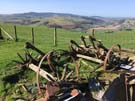
 All of a sudden Offa's Dyke Path has felt the impact of industry. Immediately on leaving Llanymynech it climbs to the limestone quarries of Llanymynech Hill. (These quarries are well-worth exploring. There's a huge continuous lime kiln that inside feels like the crypt of a brick cathedral. The view from the top of the hill above the inclined planes looking back over the Severn valley is stunning.)
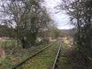
Further on, the Path crosses two old mineral railways, and approaching Chirk you can't avoid noticing the plumes rising from the Kronospan factory.
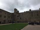 Having said that's it's still a predominantly rural walk, passing the abandoned Oswestry Racecourse, a succession of small villages and lanes, and of course, Chirk Castle.
 The Path officially bypasses the Castle, but I took the permissive path from Castle Mill past the enigmatically titled "Oak at the Gate of the Dead" to the building and had a good look round. It's a worthwhile detour.
Notes for future walkers:
- The distance above includes a there-and-back detour from Castle Mill on the River Ceiriog to Chirk Castle.
Saturday, 18 March 2017
Offa's Dyke Path
Buttington → Llanymynech
 Distance: 10.70 miles
Ascent: 73 metres
Duration: 3 hours 24 minutes
The Severn
« Not walked | Not walked »
There was something very familiar about today's walk, right from the beginning. The fingerpost at the start is the first one I ever saw on Offa's Dyke Path thirteen years ago. Back then I started driving alternate weekends between Woodbridge and Aberystwyth, taking the road that crosses the River Severn at the same point as the Path.
 Today's route follows the Severn and then the Montgomery Canal as they make their way across the plain. Initially the Breidden Hills provide the backdrop — another familiar sight from those east/west drives, although from this side the hills reveal that they're being slowly dismantled for aggregate. At the summit sits the obelisk of Rodney's Pillar and I can't help but think back to childhood party games involving keeping a cherry atop a mound of flour while excavating scoops.
 Along this stretch I caught up with Gustavo, who I'd seen across the first field outside Hay four days ago. He's from Brazil, on holiday here, walking Offa's Dyke over two weeks before moving on to Hadrian's Wall. My schedule is tighter than his so I pushed on ahead.
Almost precisely when the drizzle started I came across a self-service home-made cake stall outside an isolated house on the river embankment. Perfect timing!
 Of the entire Offa's Dyke Path, this is probably the section most capable of coping with rain. Once away from the Severn and a mile or two of Dyke across farmland, the route follows quiet roads and well-surfaced tow-paths to Llanymynech.
Notes for future walkers:
- The embankments shown on the map crossing fields between Buttington Bridge and Strata Marcella Abbey aren't visible on the ground.
- If starting from Welshpool it's probably more enjoyable to follow the Montgomery Canal all the way to Strata Marcella rather than walk down to Buttington Bridge.
- Be sure to leave time to explore the Heritage Area at Llanymynech just beyond the north of the village.
Friday, 17 March 2017
Offa's Dyke Path
Mellington → Buttington
 Distance: 13.99 miles
Ascent: 514 metres
Duration: 4 hours 31 minutes
Beacon Ring
« Not walked | Not walked »
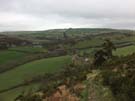
I'd identified the first half of today's walk on the final descent yesterday. The arrow-straight line of Offa's Dyke is easy to pick out as it makes its way across the broad Vale of Montgomery. It was reminiscent of some of my coastwalks in Lincolnshire: monotously following an embankment for mile after mile.
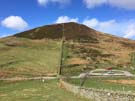
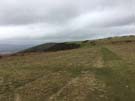
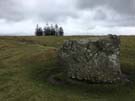
Relief came in the form of Long Mountain. The one climb of the day made its presence felt, rising to a commanding position above the Shropshire plains (though it's more a hill rather than the mountain its name suggests). The summit at one end — two miles east of Welshpool — is Beacon Ring, a large iron-age hill fort with a hidden message.
![]() The fort ticks the usual boxes: a round earthwork consisting of a towering embankment and deep ditch with two entrances, and some trees in the middle. What's unusual is that the trees are rather densely planted, and obscure a trig point in the very middle which surely couldn't have been used since planting.
The fort ticks the usual boxes: a round earthwork consisting of a towering embankment and deep ditch with two entrances, and some trees in the middle. What's unusual is that the trees are rather densely planted, and obscure a trig point in the very middle which surely couldn't have been used since planting.
The mystery is solved from the air. The trees are mainly beech, surrounding a small number of fir. They were planted in 1953, and at the right time of year the firs depict the monogram EIIR. The main question remaining for me is why commemorate the coronation in this way on top of a hill where so few people can see it? Had the same arrangement been made on the slopes the message would've been legible from the plains below, as is the case with the V of trees above Plumpton on the South Downs, commemorating Queen Victoria's Golden Jubilee.
From Beacon Ring it's downhill all the way to the end of the walk where the Path crosses the River Severn, last seen at Sedbury Cliff on day one.
Thursday, 16 March 2017
Offa's Dyke Path
Knighton → Mellington
 Distance: 15.47 miles
Ascent: 1227 metres
Duration: 6 hours 17 minutes
Halfway
« Not walked | Not walked »
The last time I set out from Knighton I was heading for Welshpool on Glyndŵr's Way. I'll be there again in two days' time, rather than the eight days it took me last year.
Today's walk is said to be the toughest of the entire Path. Pah! It's not that fearsome if you're used to coast walking or have recently completed the longer route to Welshpool.
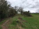
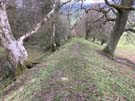 Today's walk was remarkable. Once again the Dyke was present for most of the route, but this time I somehow felt more connected to it. I've learned to read the landscape and can pick out the Dyke in the distance. It's the thing that looks like a field boundary - a line of trees or a hedgerow - but a boundary that is uninterrupted by roads and rivers. It just keeps marching over the landscape in the same direction, paying no heed to topography.
 Also of note on the route is the halfway point of the entire Path. I'm now nearer Prestatyn than Chepstow, and I'm finally allowing myself to believe that I'll complete the whole thing in this one trip. (But I've still another six days' walking to get there.)
Notes for future walkers:
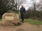
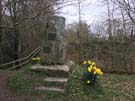 In 1971 a stone was unveiled in Knighton to commemorate the official opening of Offa's Dyke Path. Bizarrely, it isn't on the route; if you want to see it, hop west across the dyke between the Offa's Dyke Centre and the River Teme.
Wednesday, 15 March 2017
Offa's Dyke Path
Kington → Knighton
 Distance: 14.36 miles
Ascent: 822 metres
Duration: 4 hours 53 minutes
The Dyke
« Not walked | Not walked »
A transposition of two letters, and the addition of one more, separate the start and end of today's walk. This is deeply satisfying to me. Two things made the day even more satisfying: glorious blue skies and the return of the Dyke.
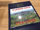
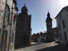 Knighton is the spiritual home of Offa's Dyke Path. It's approximately half way along the National Trail, was where the Path was launched back in 1971, and the town's Welsh name - Tref-y-clawdd - literally means "town on the dyke". There's a visitor centre here that sketches out the Dyke's history, but essentially all that's certain is that it is historically attributed to the 8th century king Offa and that it broadly approximates the England/Wales border.
Perhaps one third of the length remains visible on the ground: a raised embankment with an adjoining ditch on the Welsh side. Photographs don't do the enormity of the engineering task justice; this 200-mile earthwork must have required massive effort to construct and maintain, to the extent that it's still evident 1,250 years later.
The longest continual stretch lies either side of Knighton, making the walk from Kington an absolute joy - particularly in glorious weather. In fact, on three occasions I was so distracted by my enjoyment of the walk that I missed turnings and gates I was supposed to take.
Sadly, although I will continue to walk on the Dyke itself tomorrow, I suspect the stunning weather won't hold.
Tuesday, 14 March 2017
Offa's Dyke Path
Hay-on-Wye → Kington
 Distance: 15.40 miles
Ascent: 748 metres
Duration: 5 hours 1 minute
England
« Not walked | Not walked »
"Where are you walking to today?" asked the landlady, as I settled up this morning. "Just Kington," I replied sheepishly (after all it was to be a shorter walk than yesterday). "Kington!" she exclaimed, as if it was in a different country... which actually, it is.
 After two days in Wales, I returned to England towards the end of today's walk. Not that it was easy to tell. There's nothing on the ground to mark the border; no sign, no boundary stone, not even a fence. I think this indicates just how fully England assimilated the Principality. While there's a definitively Welsh culture, the lines are blurred and without prior knowledge you'd be hard pressed to guess which side of the border Kington lies on. Only the monolingual road signs give the game away.
 Borders on our island continue to fascinate me. Just what will happen if Nicola Sturgeon gets her way and a second independence referendum for Scotland results in a new nations' frontier on our shores? Will Wales eventually seek the same treatment? What will happen then to these border towns and common grazings that straddle the line?
 My favourite moment of the walk was at the halfway point. The mizzle was descending as I dropped into Newchurch, so a welcoming notice on the church gate offering "Tea, coffee and biscuits" was all the encouragement I needed. Inside, self-service facilities were left out on trust. This is how to get people back into churches! Why are so many locked these days when they could be centres of hospitality?
Monday, 13 March 2017
Offa's Dyke Path
Pandy → Hay-on-Wye
 Distance: 16.68 miles
Ascent: 851 metres
Duration: 5 hours 14 minutes
The borderlands
« Not walked | Not walked »
There are three segments of this walk of Offa's Dyke that I wanted to be clear of foul weather. Today was the first, and it more or less cooperated. In fact, this leg is the reason that I didn't follow through with my original plan of walking the Path in November last year, since at 703m it reaches the highest point in England south of the Peak District.
 Wait. England? Perhaps I should say "half in England" since for ten miles or so, the Path follows the border precisely along the steadily climbing Hatterrall Ridge.
 Starting out in glorious sunshine was a treat that the ever-strong wind couldn't diminish. However, that wind could bring in clouds which eventually obscured everything over 630m or so. Since the ridge broadens as it climbs, I don't think the higher views would've eclipsed those from lower down which stretched for dozens of miles in all directions.
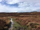
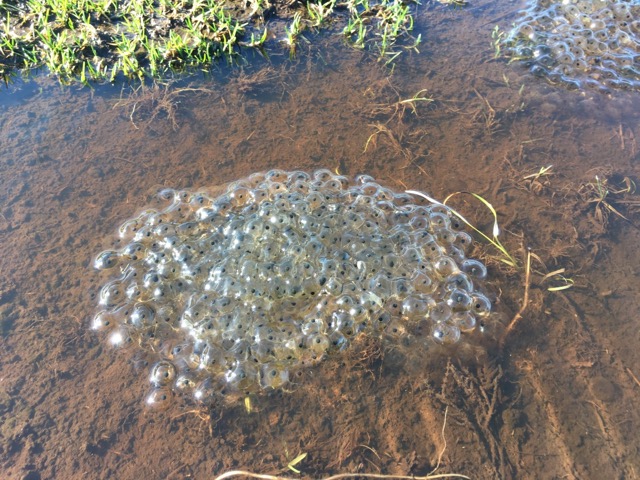 Along the high land the peat hags, which give The Black Mountain its name, have been badly eroded, but flagstones and cairns guide walkers across and around boggy sections where ponds were bursting with juicy-looking frogspawn. The long climb is one of endless false summits, and to cap it all ... well, there's the problem: as far as I could see there was nothing to cap the summit, no trig points, cairns or other markers, just an almost imperceptible sense of descent.
Eventually I dropped down into Hay-on-Wye and realised I'd crossed another subtle border, this one running east-west. Wales is a bilingual country, but which language should come first on street signs? Historically, this problem was solved by making Cymraeg first on the signs in the north, and English first in the south. From here on in I'll be reading "Araf!" before "Slow!" and all my "Pant" will be "Cudd". Another tiny change, another sign of progress.
Sunday, 12 March 2017
Offa's Dyke Path
Monmouth → Pandy
 Distance: 16.49 miles
Ascent: 672 metres
Duration: 5 hours 19 minutes
Remarkable trees
« Not walked | Not walked »
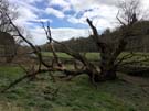
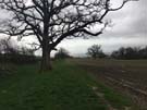
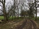
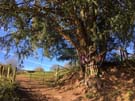
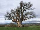
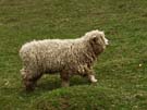
What stood out most for me today were the trees. Soon out of Monmouth the path works its way through an area of forest, but those aren't the trees I'm thinking of: the remainder of the walk was through farms and across fields, and in almost every one stood an old wizened tree watching over the crops and livestock.
In the bedroom of last night's B&B was a book called "Meetings with Remarkable Trees". I didn't read it - the title alone spoke volumes - but I'd like to think there's a chapter in there about the fields of Monmouthshire.
Three other images stand out: White Castle, St George and Hatterrall Ridge.
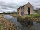
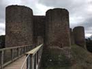 The castle is one of three joined by a waymarked walking route, but the only one of the Three Castles that Offa's Dyke Path directly passes. It's everything a castle should be: a stable ruin, free to enter, with minimal interpretation. It has an outer ward and an inner keep surrounded by a moat. Utterly delightful.
 The encounter with St George was unexpected. The whitewashed exterior of St Cadoc's church in Llangattock Lingoed was startling enough, but inside – just to the right of the main door – is a life-size painting of St George vanquishing a recalcitrant dragon. The colours are faded, and the dragon a little indistinct. Does the dragon represent the Welsh nation being conquered by the English? The relationship between the two countries will be something on my mind for much of the week as I cross back and forth over the border.
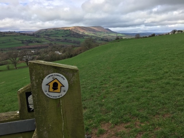 Then finally Hatterrall Ridge fell into view as the walk ended. Illuminated by a spotlight of sun, the golden brown bracken-covered high ridge was a welcome change to today's farmland. Or rather, it will be; the majority of tomorrow's walk involves walking the length of the ridge. I can hardly wait.
Saturday, 11 March 2017
Offa's Dyke Path
Chepstow → Monmouth
 Distance: 17.65 miles
Ascent: 1017 metres
Duration: 6 hours 19 minutes
The Wye
« Not walked | Not walked »
On 20 February 1999 I completed my first ever stage of a National Trail. As I collapsed into an armchair at the Poppit Sands YHA, one of the other hostellers tried to empathise: "I started walking Offa's Dyke last year," he said. "Gave up after the first day. Couldn't do it." And so for the last eighteen years I've been a little nervous about the walk to Monmouth (that's part of the reason I shaved two miles off it yesterday).
For much of today I've been expecting a nightmare path around every corner. While there are plenty of steep sections – which were particularly slippery today – the route was actually rather tame.
 The River Wye winds its way from Monmouth to Chepstow, cutting a deep cleft in the countryside. The Dyke follows high above through thickly wooded slopes. Most of the walk was in this woodland.
I'm beginning to see the Dyke in every earthwork (much as I now see every mound of earth in Suffolk as a burial mound). It'll be a while before I'm "tuned in" to this landscape.
 Despite the day being hazy and overcast, there were still absolute highlights, particularly the view from the Devil's Pulpit down across the Wye to Tintern Abbey.
 Just outside Monmouth the Path finally crosses the river and enters Wales. Now I've completed the walk that I've been fearing all these years I can look forward to the rest of the way to Prestatyn with confidence.
Friday, 10 March 2017
Offa's Dyke Path
Sedbury Cliffs → Chepstow
 Distance: 1.94 miles
Ascent: 98 metres
Duration: 36 minutes
A prelude
« Not walked | Not walked »
Here's the plan: over the next twelve days I'll walk the length of Offa's Dyke Path. It's the only National Trail in Wales that I've not completed, and when I reach Prestatyn a week on Wednesday it'll join up with my walk round the Welsh Coast to create the longest circular walk I've done so far.
 This time I'm on my own. Emma's at work, and although I enjoyed Mum's chauffeuring (and company) on Glyndŵr's Way last year, I decided to try and complete this walk unaided. I've booked accommodation for each night, and I intend to not use any form of transport other than my two feet until I reach the north coast.
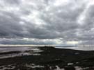
The path itself starts incongruously on a cliff north of the Severn Bridge. It's a seemingly arbitrary point until you realise that there really is a Dyke and it is here, where the land meets the sea, that it finishes.
 After a short walk along a segment of earthwork, the two miles into Chepstow aren't particularly inspiring save for the fact that they're the start of a big walk, and the north coast beckons.
 Perhaps of more interest is how I reached the start. I looped around Beachley Point, where the Wye and Severn kiss and make up after their race from the summit of Plynlimon.
Wales Coast Path
M48 J2 → Chepstow
 Distance: 2.86 miles
Ascent: 111 metres
Duration: 52 minutes
A coda
« Not walked | Not walked »
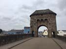
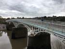
Five years after completing the Wales Coast Path, how do I find myself finishing it again? Back in January 2012 we crossed into England on the Wye Bridge, but the Coast Path that was officially opened later that year has its formal end point a couple of miles further up the Wye in Chepstow. It makes for a more attractive end, rather than the somewhat abrupt mid-bridge stop indicated only by a motorway marker post.
But I'm a completer, so the little chunk from the Bridge to Chepstow has been teasing me for too long.
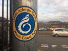
The path is extremely well signposted, with the Coast Path's stylised dragon logo appearing at reassuringly frequent intervals on lamp post stickers, finger posts and even discs embedded in the pavement. Whenever I was unsure of where the route went next I needed only look briefly for the next waymark.
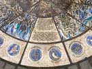 A mural set into the riverside path by The Boat Inn is the official end. It's somehow unsatisfactory. Perhaps this is because the upright stones on either side indicate the bigger walk on my mind.