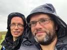
Friday, 28 September 2018
Hadrian's Wall Path
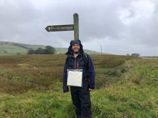
Carlisle → Bowness-on-Solway
 Distance: 15.54 miles
Ascent: 170 metres
Duration: 5 hours 30 minutes
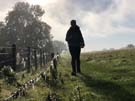
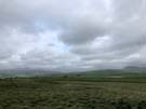
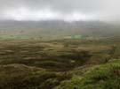
The salt marsh
« Gretna | Not walked »
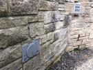
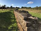
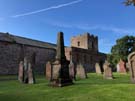 Hadrian's Wall Path follows the coastline for most of its length west of Carlisle, so I've walked much of today's leg before. After following the River Eden through Grinsdale, Kirkandrews-on-Eden and Beaumont, the path finds itself at Burgh by Sands where the church contains fragments of decorative Roman masonry built into its interior, and a plaque commemorates the first recorded African community in Britain, a cohort of Ethiopian soldiers who guarded a local fort.
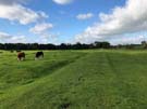
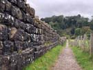
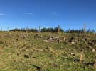
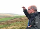
 We were soon on the course of the Wall again, walking the long, straight road over the tidal Burgh Marsh. An 8.9 metre tide was scheduled for the afternoon, almost guaranteed to flood the road, so although it was tempting to linger and admire the expansive view we hurried on to the safety of Drumburgh at the western end of the causeway.
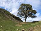
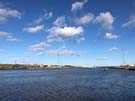
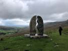
Stopping briefly at the Post Carlisle photo opportunity, we followed the end of the Wall Path along the narrow road to Bowness on Solway. The views here were spectacular: the Scottish lowlands to the north and shimmering reflections of clouds above the Solway Firth.
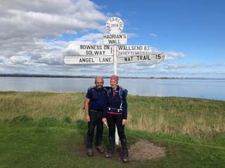
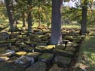
The official end of the Path comes as a slight surprise: a small wooden shelter stands over a mosaic floor, decorated with pictures of the many wading birds that accompany the finals stage of the route along the Firth. Although this walk has been all about military engineering, it's as much about how humans have adapted to, and worked with, the huge natural landscape.
Thursday, 27 September 2018
Hadrian's Wall Path
Walton → Carlisle
 Distance: 11.54 miles
Ascent: 125 metres
Duration: 3 hours 54 minutes
Completing the circuit
« Not walked | Beaumont »
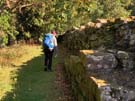
We think we're beyond the last of the in-situ masonry of Hadrian's Wall now. All that's left is the impression of the Vallum crossing the increasingly agricultural landscape.
 Approaching Carlisle the Path turns away from the invisible route of the wall, favouring a riverside meander along the River Eden instead.
 Just east of the city we paused briefly where we crossed the M6 motorway to recognise that the next time we pass under that bridge we'll be driving north to a new home in Scotland. It's a moment that can't come soon enough.
 Another significant point came at the end of today's walk. We actually walked on beyond the formal end point of the leg to the disused railway bridge over the River Eden. Sneaking between the iron railings protecting walkers from the old structure, it was there that I crossed the river on my coastwalk in 2004. So with this little extra added, we completed our longest continuous walking circuit yet: around most of the coastline of England and Wales, then back to Carlisle along this week's ancient route.
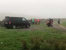
Wednesday, 26 September 2018
Hadrian's Wall Path
Steel Rigg → Walton
 Distance: 17.24 miles
Ascent: 765 metres
Duration: 6 hours 39 minutes
Into the wind
« Not walked | Not walked »
The wind was our greatest foe today. From the moment we woke up at The Sill YHA we knew what was against us: looking out of the window, all the trees were standing defiantly but their branches stretched out wildly, giving the game away,
 Heads down with hoods tightened, we headed west. Again we were on familiar territory across the backs of crags that we'd climbed in March. A young cat bounded up the path to greet us at Thirlwell Castle, and shortly after we parted company with the Pennine Way to continue on as-yet-unknown territory.
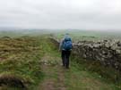
 Detours were the order of the day once we'd crossed into Cumbria, with a collapsed footbridge, another under reconstruction and a re-routing of the path all nudging us away from our originally intended route. The National Trails website is an excellent resource for learning about such things, so none of them took us by surprise.
 At Birdoswold Fort we saw some rude tourists who seemed singularly unimpressed with the wall itself. Perhaps their expectations had been set unfairly high; having walked alongside it for four days (so far) meant that all we could do was shake our heads in disagreement.
Tuesday, 25 September 2018
Hadrian's Wall Path
Chollerford → Steel Rigg
 Distance: 12.84 miles
Ascent: 771 metres
Duration: 4 hours 36 minutes
The craggy days
« Not walked | Not walked »
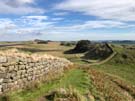
That's more like it! We always knew today's walk (and most likely tomorrow's) would be a highlight of the week, but that it would also be difficult. Welcome to the middle third of Hadrian's Wall Path, otherwise known as "the craggy days".
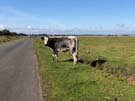
 The first part of the day was similar to yesterday, marching alongside the Military Road. There were more wall fragments to look at including a particularly fine temple to Mithras at Brocolitia Fort. Once we reached Sewingshields the character changed completely as Hadrian's soldiers hammered on across the rocky crags but General Wade — intimidated by the Whin Sill — took his road slightly further south. Even the Romans gave up eventually though: at Limestone Corner the quality of workmanship takes a sudden decline as the soldiers passed the construction baton to geological forces. This section is frequented more by cattle than humans, and it's fascinating to see them milling around the Roman remains.
 Before long we were at Houseteads Fort, and completed the day by re-walking a stretch that we'd traversed earlier in the year on the Pennine Way as far as Steel Rigg. It's a fine section to repeat, with highlights including the only section of wall which has a public footpath running along its top, Castle Nick and Sycamore Gap. The switchback of the path was well worth the effort as it clung to the rippling landscape.
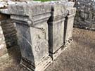
 Our fast pace today meant that we reached the end of this leg with sufficient time in the bag to spend most of the afternoon exploring the extensive remains at Vindolanda, a Roman settlement that pre-dates the wall just a few miles to its south.
Monday, 24 September 2018
Hadrian's Wall Path
Heddon-on-the-Wall → Chollerford
 Distance: 15.63 miles
Ascent: 403 metres
Duration: 5 hours 28 minutes
A tedious trudge
« Not walked | Not walked »
Unlike yesterday, we've never been far from Hadrian's Wall but there's not been much, if any of it, to see. Blame General Wade. When constructing a military road between Carlisle and Newcastle he followed the route of the Roman Wall precisely, either robbing it for materials or building directly on top of it.
Over the centuries Wade's road has been upgraded and now forms the modern B6318. So to make matters worse, we've pretty much been on the course of a trunk road all day.
 There was curious wall-building of a modern kind to be seen though. At East Wallhouses, two defunct games consoles have been used in place of stones in a garden wall. I don't think this wall will be round long enough for archaeologists to be baffled by it though.
 Once again the highlights came towards the end. Just outside the village of Wall the road and wall diverge, leaving a fantastic stretch of Roman ruin running through the field.
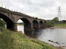
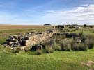
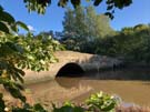
 A little later the wall crosses the North Tyne River, and a brief detour from Chollerford Bridge gives access to the ruins of the old Roman bridges. This must have been a spectacular piece of engineering; all that's left now is a group of stones arranged in the grass by the bank.
Tomorrow promises to start with much of the same, before finally hitting the spectacular crags.
Sunday, 23 September 2018
Hadrian's Wall Path
Wallsend → Heddon-on-the-Wall
 Distance: 16.50 miles
Ascent: 255 metres
Duration: 5 hours 18 minutes
Walls end
« Not walked | Not walked »
As hinted at ten days ago, it's time to start walking the last National Trail: the Wall. Today though, there's not been much Wall to see.
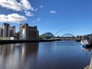 Hadrian's Wall extended from Wallsend on the Tyne to Bowness-on-Solway in Cumbria, but since its construction in the second century different parts have endured different fates. Here at the eastern end there's little evidence left on the ground. While the outline of a Roman fort can be made out at Wallsend, there's nothing to be seen of the Wall that passed through what is now modern Newcastle. The Path then takes to the riverbank, following the Tyne through the town (and under its famous bridges; we stopped to enjoy roast pork stotties from a stall in the busy market).
 On the edge of the town a touching monument commemorates the Montagu View pit disaster of 1925. Thirty eight men and boys were killed by a surge of flood water and methane, caused by a routine blast penetrating into the abandoned workings of the adjacent Paradise Pit. The men who laid the blasting charges were covering for others who had overslept on the day; the pit plans - which would have shown the surrounding workings - weren't available. This avoidable accident took the lives of 22 people from the small village of Scotswood, a devastating loss.
 Hadrian's Wall Path crosses the A1 and finally heads north and uphill to the village of Heddon-on-the-Wall where at last the remains of the actual wall are visible (though not directly on the route of the Path). The wall's an impressive structure. We've seen it before on our Pennine Way traverse, but found it hard to imagine the extent of the structure. Walking its entire length this week, even though evidence of the physical wall will be missing in many places, will enable us to appreciate first hand the sheer enormity of this coast-to-coast construction.
Notes for future walkers:
- At Segedunum, take a moment to walk to the north west corner of the fort where a reconstruction of the wall shows its estimated height.
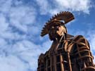
- The actual starting point of the National Trail isn't entirely clear, but seems to be the sculpture of a Roman soldier in the Segedunum car park.
- The Path has been rerouted away from the river bank at NZ 151 652, running north until it joins the Waggonway running west.
- The existing stretch of wall in Heddon-on-the-Wall is on the south side of the B6528 just east of the village.
Saturday, 22 September 2018
Coastwalk
Howdon → North Shields
 Distance: 3.77 miles
Ascent: 73 metres
Duration: 1 hour 2 minutes
Shields Harbour
« Not walked | Whitley Bay »
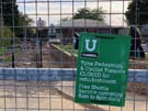
Our hopes to walk under the Tyne from Jarrow have been scuppered. The pedestrian and cyclist tunnels under the Tyne only opened in 1951, but have been closed for the past five years for extended refurbishment. So we've opened a "gap" in our coastwalk as we took a shuttle bus across the river.
The land on the north bank of the river has been redeveloped faster than the south. Instead of negotiating disused quays and wharfs, there's a maze of marinas and apartment blocks, not quite linked by dead-end roads and a conspicuous lack of thought for through-walkers. The route we took was on slightly higher ground though, giving us a better view of the activity on the river below.
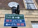 We were soon at the ferry terminal at North Shields, where we were delighted to see that since last coming here in 2013 an "England Coast Path" sign has been erected to welcome circumnavigators crossing the river by boat.
Tomorrow we'll turn our back to the coast and head west across the neck of the country.
Coastwalk
South Shields → Jarrow
 Distance: 4.03 miles
Ascent: 64 metres
Duration: 1 hour 11 minutes
A coastal prelude
« Seaham | Not walked »
The observant will have noticed we've not added to the coastwalk this year. Time to rectify that.
Our goal for the coming week is to walk Hadrian's Wall Path, the only one of England and Wales' National Trails that I've not yet completed. The path connects with the coast at the western end, but not at the east. Before we start on the week's walking then, we're heading up-river from the Shields Ferry to the Tyne Tunnels (just a mile and a half from Hadrian's Wall Path's eastern terminus) and back.
 The southern bank of the river is out of reach for this stretch, barred by docks and car terminals. There's a moment of relief at Jarrow where a footpath follows the bank of a stream past Jarrow Bridge and the remains of Jarrow Monastery, but even that is short-lived and dominated by electricity pylons. A glimpse of the river follows before it's hidden again behind high steel fences surrounding yet another wharf that's being slowly reclaimed by nature.
Wednesday, 19 September 2018
Album , Gig , Theatre
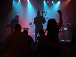
Northern Flyway
We came across Northern Flyway by chance in January. With a gap in our schedule for the weekend we were at Celtic Connections in Glasgow, we picked the show from the programme that sounded most interesting (and besides, Sarah Hayes was playing in it; we'd seen her with Admiral Fallow).
Taking our seats in the Tron Theatre back then, we didn't know what to expect. Tonight was different: we'd seen the show and knew the music so had to return to for the London date of the tour.
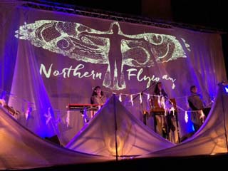
Just about every way of classifying Northern Flyway won't do it justice. Is it folk music? Beatboxing? Theatre? Nature documentary? Birdsong catalogue? And dare you mention the gorgeous custom knitware?
Imagine all these elements brought to life with beautiful harmonies and a heartful of joy and you'll begin to approach the experience.
Two curlews duet about their lifelong bond, singing of dancing above heather moorland; waxwings flock and wheel around the sky in a twittering bundle, and owls find safety and shelter in the statue of Athena, their ancient protector and the source of the enduring myth of their wisdom. Folklore, ornithology and sociology mesh together. Stories of the struggles of migration apply equally to bird and human endeavours.
Perhaps we're sounding too enthusiastic. But here's the thing: Northern Flyway is a unique production that we're delighted to have caught. We'd recommend everyone go along.
And if you can't get to a show, the album was released last week providing the sonic experience if not the video and knitware.
(For bonus marks, pick up Jenny Sturgeon's The Wren and the Salt Air E.P., which perhaps marks the genesis of the Northern Flyway project. We came away tonight with two of Inge Thomson's CDs so we have homework of our own.)
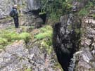
Monday, 10 September 2018
Pennine Bridleway
Settle Loop
 Distance: 11.17 miles
Ascent: 555 metres
Duration: 3 hours 30 minutes
Joining up
Although I've completed the current linear Pennine Bridleway, there are still some optional extras left. The Trail includes two loops off the main route, and at about ten miles the Settle Loop is the shorter, providing a good morning walk.
 For twenty years or so I had difficulty locating Malham on a map. It's up a bit of a dead end, and by road it's not particularly near anything. The Settle Loop challenges that perception, extending four miles east of Settle to provide a clear view of Malham Tarn (if not the Cove itself).
 I've really enjoyed "joining up" my knowledge of our island's geography on my walks, and there is no finer example than this. Looking east I remembered my first ever trip to Malham and Gordale Scar, as well as last year's passage through the village on the Pennine Way. On the return leg to Settle the Yorkshire Three Peaks presented themselves proudly on the horizon, reminding me again of last September, but also of this year's walks along the Bridleway. It's deeply satisfying to be able to scan such a wide horizon and see familiar features in almost all directions.
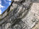
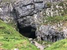 I detoured from the line of the Loop briefly to explore the Victoria Cave, a deep cleft in the limestone.
Its location just couple of miles outside of Settle was evident in that I met about a dozen people walking on these last few miles, but hadn't seen a single soul previously. I prefer the solitude of having the path to myself, but it's always comforting to see friendly faces.
Sunday, 9 September 2018
Gig
Niteworks
Back in Settle Victoria Hall, this time for a band I've seen before.
What you need to know about Niteworks' performance tonight:
- They had everyone dancing: from teenagers right up to eighty-somethings.
- The music scarcely stopped, band members switching instruments seamlessly without waiting for applause at the end of a song.
- By the end, everyone was exhausted, and everyone was grinning.
Even if the thought of Gaelic electronic dance music with bagpipes and poems doesn't sound appealing, go and see Niteworks anyway; you will be converted.
Pennine Bridleway
Garsdale Head → Street
 Distance: 10.37 miles
Ascent: unknown
Duration:
A disappointing end
« Not walked | Not walked »
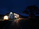
It's always a joy to stay overnight directly on the path. The convenience is one thing, but also you often meet like-minded walkers in the bar or over breakfast. And so it was at the Moorcock Inn, where we chatted with a couple from Ayr. They were in the area with their local walking group, the majority of whom we'd met the previous night in Hawes YHA, but our friends had made the sensible decision to eschew dormitories, bunk beds and self catering for this comfortable B&B.
 Although the weather forecast for today was significantly better than yesterday's, we set out from the pub into a persistent drizzle. A relatively short climb took us to Lady Ann's Highway, a track which although level became higher and higher above the valley floor as the nascent River Eden dropped away.
 Heads down into the wind we didn't see the allegedly beautiful Hell Gill, but did stop for a breath at the Water Cut sculpture. Beyond here the path dropped to the valley road but before then the view was delightful, with rich farmland ahead, flanked on either side by the high, rocky moorland of Mallerstang Common.
The rain held off during our descent but returned as we ascended the flank of Wild Boar Fell to the pass at High Dolphinsty. Hopes of a clear view ahead were dashed by yet more low cloud, but at least the precipitation wasn't too heavy.
 Rather soon we reached tarmac, and before long the A683 where the Pennine Bridleway presently comes to a rather abrupt and underwhelming end. Plans to extend the trail for another hundred miles or so through Northumbria to Byrness have been approved but no funding has been secured to construct the path.
All in all the Pennine Bridleway isn't the best National Trail. It has its moments; it runs through some spectacular scenery, but by design it doesn't follow a natural theme. Instead its purpose is to get people to places. For walkers it's a good route for passing swiftly from the Peak District to the North Pennines. Perhaps it'll find purpose as an element of LE-JoG routes that don't want the drama of the Pennine Way.
For me it'll always be the National Trail I was least fussed about finishing, but when I realised I was so close to completing all the others it would have been churlish to omit this one.
Walking from the end of the trail to the railway station at Kirkby Stephen we could make out the radar station on Great Dun Fell and to its north, the bulk of Cross Fell. I remembered the Pennine Way's onward route, and how just a couple of days' walking from where we stood would take us to Hadrian's Wall.
National Trail 14 is complete. Just one left, and it's along that Wall.
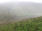
Saturday, 8 September 2018
Pennine Bridleway
Birkwith → Garsdale Head
 Distance: 16.10 miles
Ascent: 645 metres
Duration: 5 hours 6 minutes
The Three Peaks
« Not walked | Not walked »
The summer is officially over, but the hardy are trying to eke out as much as they can of its remaining moments. That's why I'm up in Yorkshire once more, keen to spend the next two days finishing off the Pennine Bridleway. For the first time on this National Trail I'm not alone. Jez has joined me for the weekend and the last twenty-five miles.
 Finding somewhere to park in Horton-in-Ribblesdale this morning was far from simple, and that fact was not entirely unrelated to the twenty or so people we came across just forty-five minutes into our walk. Horton is the natural place to start the Yorkshire Three Peaks Challenge, and the dozens of energetic twentysomethings we saw at High Birkwith had parked up and set out for Pen-y-Ghent probably before we'd even had breakfast.
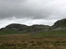
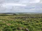
It wasn't a good day to climb those hills. None of the three were really visible through the low cloud, and we were glad to be generally contouring round the edges of the valleys rather than aiming for the tops.
 For a while we joined the Pennine Way, but soon the Way and Bridleway diverged at their most northerly meeting point on the Roman Cam High Road.
It's such a shame the weather was so poor. There ought to be so much more to report about this walk, such as the magnificent Settle to Carlisle railway line snaking its way along the valley, diving into tunnels and thrusting out across viaducts between tortuously steep gradients. We did see the line through a couple of gaps in the cloud, but a strike today meant that no trains were running; the line was silent.
 Tonight we're staying at an isolated inn on a high pass between three dales. We arrived tired and soaking wet, but it's the sort of place where guests are expected to be disheveled. Of course within half an hour of our arrival the rain stopped and the sky began to clear. Perhaps that bodes well for tomorrow.
Friday, 7 September 2018
Yorkshire Dales
Cove and Scar
 Distance: 7.72 miles
Ascent: 248 metres
Duration: 2 hours 44 minutes
17. Around Malham
Here's a walk I've done twice before. It's a bit of a classic: a Malham circuit taking in the waterfalls of Janet's Foss and Gordale Scar before reaching Malham Cove via Malham Tarn.
It's a walk of high drama, and the centrepiece is climbing beside the waterfall at Gordale Scar. The climb is a fairly straightforward short scramble, made more intimidating by the thundering water alongside and the prospect of a dozen or so less adventurous spectators wondering what the heck you're doing. Stay to the left of the main cascade, and it'll be over before you know it. I genuinely believe pretty much anyone can do this.
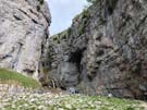
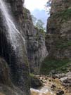
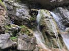
It's been twenty-five years since I first completed the circuit, and last time I tried water levels were too high to safely complete the ascent. But today conditions were perfect. An ideal warm-up for a couple of days in the Dales.