Monday, 13 March 2017
Offa's Dyke Path
Pandy → Hay-on-Wye
 Distance: 16.68 miles
Ascent: 851 metres
Duration: 5 hours 14 minutes
The borderlands
« Not walked | Not walked »
There are three segments of this walk of Offa's Dyke that I wanted to be clear of foul weather. Today was the first, and it more or less cooperated. In fact, this leg is the reason that I didn't follow through with my original plan of walking the Path in November last year, since at 703m it reaches the highest point in England south of the Peak District.
 Wait. England? Perhaps I should say "half in England" since for ten miles or so, the Path follows the border precisely along the steadily climbing Hatterrall Ridge.
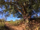
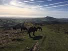
 Starting out in glorious sunshine was a treat that the ever-strong wind couldn't diminish. However, that wind could bring in clouds which eventually obscured everything over 630m or so. Since the ridge broadens as it climbs, I don't think the higher views would've eclipsed those from lower down which stretched for dozens of miles in all directions.
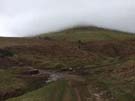
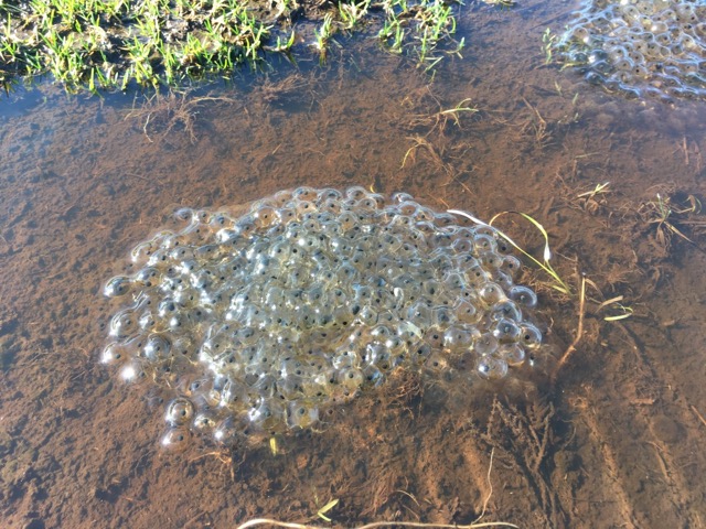 Along the high land the peat hags, which give The Black Mountain its name, have been badly eroded, but flagstones and cairns guide walkers across and around boggy sections where ponds were bursting with juicy-looking frogspawn. The long climb is one of endless false summits, and to cap it all ... well, there's the problem: as far as I could see there was nothing to cap the summit, no trig points, cairns or other markers, just an almost imperceptible sense of descent.
Eventually I dropped down into Hay-on-Wye and realised I'd crossed another subtle border, this one running east-west. Wales is a bilingual country, but which language should come first on street signs? Historically, this problem was solved by making Cymraeg first on the signs in the north, and English first in the south. From here on in I'll be reading "Araf!" before "Slow!" and all my "Pant" will be "Cudd". Another tiny change, another sign of progress.