Saturday, 26 September 2015
Coastwalk
Newburgh → Cruden Bay
 Distance: 12.38 miles
Ascent: 247 metres
Duration: 4 hours 4 minutes
One more church
« Bridge of Don | Peterhead »
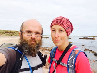
We've already walked further than we'd planned this week, but there was still time for one more outing, one more abandoned church.
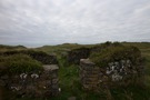 Local legend is rife with tales of how the medieval village of Forvie came to be buried in the sand. All that remains now are the forlorn four walls of the church. It's a haunting spot, but there's little here to indicate that the building was a place of worship. I prefer the churchyards we've seen elsewhere this week.
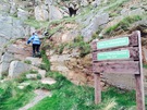
At the church the sandy interlude that began in Aberdeen comes to an end. Before we reached the village of Collieston, the rocky terrain had asserted itself against any attempts to tame it with a straightforward path. The way out of the village started with a clamber up a steep rock face.
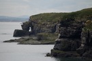 Though a formal path at this point, it was of poor quality and so when we reached Old Slains Castle we switched to the backroads despite a sign indicating that the path ("Sponsored by Energetica") would continue to Whinnyfold.
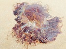 We were racing against the clock: the map suggested that the beach at the Bay of Cruden might be tricky at high tide so we were hoping to get there early. In the end we reached the beach more-or-less bang on high tide, and didn't have any difficulties - other than dodging the jellyfish that had been washed onto the sand.
We've had a great week here in the north-east of Scotland. Next time we'll turn the corner towards Inverness, and from there John O'Groats seems only a short hop away.
Notes for future walkers:
- We followed the well-marked track across Forvie National Nature Reserve from the car park at NK 004 270 through NK 004 268 and NK 011 269 to Forvie Church at NK 020 265.
- From Forvie Church a good clifftop path leads to Collieston.
- In Collieston drop down to the harbour as soon as possible; a path leads through the Low town to the car park on St Catharine's Dub
- A well marked path starts at the car park heading for Old Slains Castle but begins by clambering up the rock.
- From Old Slains Castle (NK 051 300) another signposted path claimed to follow the coast to Whinnyfold but we were pushed for time so stuck to the roads (NK 048 301, NK 045 305, NK 047 308, NK 068 325, NK 069 325, NK 077 334, NK 081 332).
- At Whinnyfold we rejoined the clifftops, soon dropping to the beach at the southern end of Cruden Bay (NK 083 338).
- It looks as through the beach at the Bay of Cruden can be walked at all states of the tide; despite planning to the contrary we reached it near high tide and didn't have any trouble.