Friday, 27 March 2015
Peddar's Way / Norfolk Coast Path
Holme next the Sea → Castle Acre
 Distance: 20.35 miles
Ascent: 341 metres
Duration: 5 hours
The Roman Road
« Not walked | Not walked »
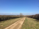
The ancient routes criss-cross our land. We know their names: Foss Way, Watling Street, Stane Street. Many have been upgraded over the years, layered with Tarmac and widened to dual carriageway. Pedlars Way is different. Seemingly going nowhere, the route serves no purpose to modern life so has been left abandoned, a farm track, a walking route, an echo of the past.
 Deer, partridge, pheasant, rabbit: I've collected the full set of wild animals today. And as the dunes of Holme receded and the arable fields turned to livestock I added pigs and horses to the list.
Walking such a long distance in so straight a line provides opportunity to appreciate how the landscape changes. It's a fallacy to claim that East Anglia is flat!
Castle Acre is the only village of any substance on Peddars Way, but even then it only supports one pub and a handful of B&Bs. "There used to be seven pubs," my host told me, "the last one to close was just a couple of years ago." It's a shame, but trade in the remaining Ostrich Inn tonight suggests there's community enough to keep it running. (Warning: the Inn's menu refers to their Toad in the Hole as having a "Giant Yorkie". They're not kidding; I could've used it as a hat, even for my humungous head!)
The castle itself is worth exploring; not much left by way of buildings, but hugely impressive earthworks and open all hours, for free! English Heritage also look after an old Priory here too, but it was closed when I arrived so other than reporting that the buildings look impressive from the road, I can't say much more about it.
Tomorrow's another 20 miler. The weather forecast doesn't look good. Wish me luck.