Monday, 9 September 2013
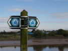
Coastwalk
Preston → Tarleton
 Distance: 12.34 miles
Ascent: 47 metres
Duration: 4 hours 18 minutes
The Ribble
« St Anne's-on-Sea | Southport »
Before we can claim to have conquered the English Coast there are a few pesky "gaps" we need to fill. This week we're taking a break from our march up the east coast and focussing on two areas in the north-west.
 For the first six miles out of Preston we followed the Ribble Way, a long distance path that follows the River Ribble from its source at Ribblehead but rather incongruously stops at a pub beside the River Douglas, some 15 miles short of the river mouth between Southport and Lytham.
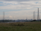
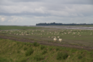 It's interesting to look across to the east from here and recognise that the Ribble is more-or-less at the same latitude as the Humber. And the coast path here certainly feels familiar, with mile upon mile of flood bank protecting low-lying farmland from the highest of tides. The Ribble is said to be the only river rising in Yorkshire which flows west, the majority of the remaining rivers ultimately joining the Humber itself.
 We pressed on beyond the end of the Ribble Way and having detoured around a footpath that itself contained a "pesky gap", crossed the Douglas to the charming village of Tarleton on the opposite bank. From the map you'd expect Tarleton to be a quiet, mostly residential place with a smattering of farm buildings. What we found was a thriving community with a bustling village high street.
Tomorrow we head back up the Douglas to follow the Ribble once more to its true end.
Notes for future walkers:
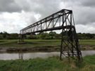
There is a pipe bridge that crosses the Douglas directly opposite Hesketh Bank. Other walkers have suggested it might provide suitable access to the village. Don't believe them. Hopefully the local council will eventually deliver on their 2008 promise for a new pedestrian bridge near here.
At SD 459 250, the path running north from Lower Marsh House stops short of the east/west path to Hall Green. Although it looks as though Access Land links the two paths, there's a dyke in the way without a bridge. We detoured via Hall Carr Lane and the footpath past Odd House Farm, although a quick trespass round the head of the dyke might be a better route.